California CEQA record · October 16, 2026
Village A
Public California environmental records identify Serrano Village A as part of the southern portion of the Serrano Residential Development.
Read the public record Talk with Chris
Village and location orientation
Serrano village naming, property boundaries and governing requirements are specific to the address. This is an orientation layer based on public references—not a complete directory, map of access rights or live-lot index.
Publicly documented references
The following labels appear in public California records. They are included to help frame location research, not to suggest current availability, a complete village list or a particular development phase.
Public California environmental records identify Serrano Village A as part of the southern portion of the Serrano Residential Development.
Read the public recordA public California record places Serrano Village A14 east of Silva Valley Parkway and south of the Village Green Drive / Russi Ranch Drive intersection.
Read the public recordA public California record identifies Serrano Village K1 / K2 in connection with a pedestrian-trail project at Allegheny Creek.
Read the public recordSerrano trail explorer
Explore the CSD’s current source-map context, then use the official guide and field signage for the actual route. This is an orientation aid—not turn-by-turn navigation, a property-line map or an access-rights determination.
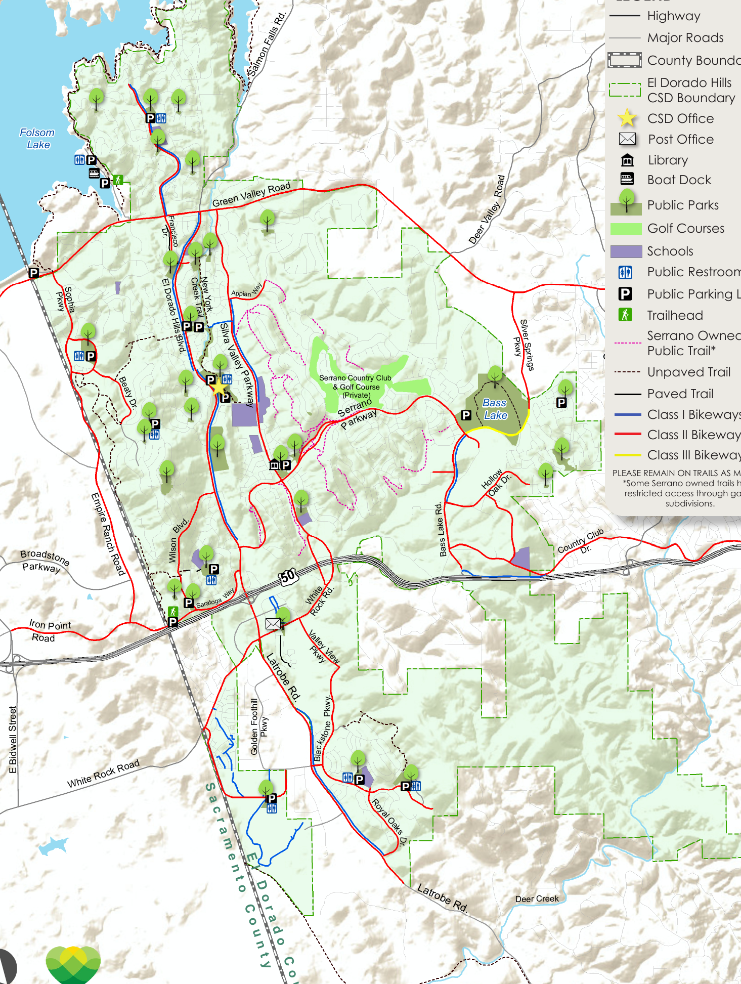
Source map: 2022 official pocket-map edition. The underlying agency notation is retained; only the surrounding interface has been restyled.
Names can orient an initial search. The actual parcel, recorded documents, current listing data, boundaries, association process and field conditions determine what a buyer needs to know.
A practical search brief
Where to go next
Chris Wolfe can help translate your location priorities into a current Serrano search and the exact questions to take into due diligence.
Talk with Chris